
Caribbean
Ecosystems: Coral Reefs, Mangroves, Seagrasses
Ecosystem Services: Coastal Protection, Fisheries, Recreation & Tourism
Projects & Places: Cuba, US Virgin Islands, Bahamas and Andros Island, Cayman Islands, Region-wide projects
Approaches: Coral Reef Larvae Connectivity Model, Unmanned Aerial Systems
A Mosaic of Marine and Coastal Habitats
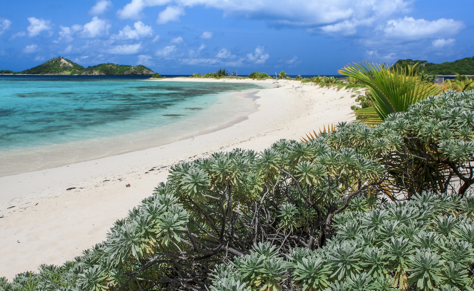
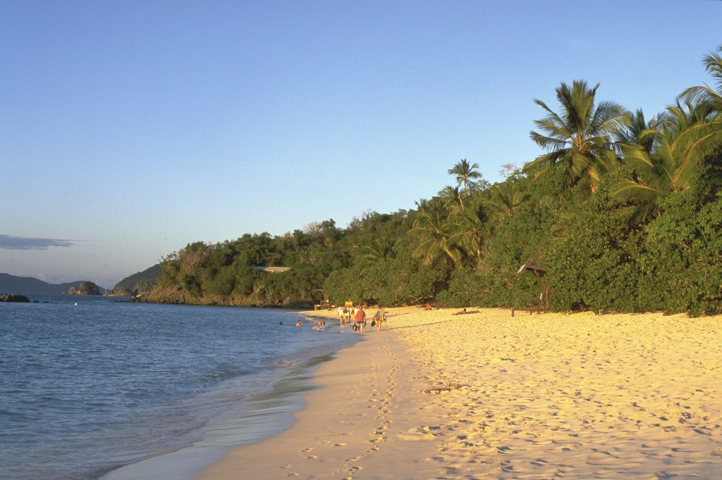
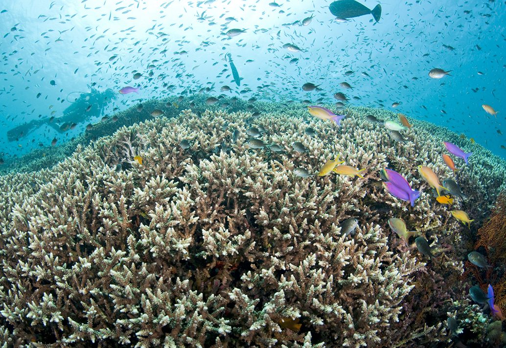
The Caribbean region is one of the world’s most complex mosaics of marine and coastal habitats, comprising 10 percent of global coral reefs, 18 percent of seagrass beds, and 12 percent of mangrove forests. It also boasts 1,400 species of fish. Most of the region’s 40 million people are directly or indirectly dependent on the health of coastal marine ecosystems, with a robust tourism industry that provides both a challenge and an opportunity for advancing conservation at ecologically and socially meaningful scales. More information on the Caribbean team’s work can be found here and on their Facebook and Instagram. Visit the Caribbean Science Atlas for data and information resources for marine management in the Eastern Caribbean.
Projects and Places
At the Water's Edge (Grenada)
The objective of the At the Water’s Edge (AWE) project is to build resilient island communities using nature-based solutions by empowering people to assess the social, ecological and economic risks of climate change and make informed decisions on the use of their coastal environment.
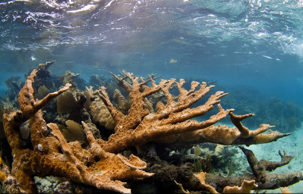
In Grenada, TNC works with community members in Grenville Bay to address the deterioration of the northern barrier reef. Coral reefs protect coasts from erosion and flooding by reducing wave energy that reaches the shore. Numerous human influences have led to a decrease in the coral cover on this barrier reef. When the reef is no longer able to ‘grow’ at a rate faster than the rate of erosion from the constant breaking waves, the reef height begins to decrease. This lowering of the reef severely limits the reef’s ability to protect the coastline from the impacts of wave intensity and storms, leading to coastal erosion and an increase in run-up flooding from waves during storms. The Grenville project is testing a two stage approach to restore the shoreline protection function of the barrier reef. More information can be found here.
Bahamas (Andros Island)
To assist the process of extending the Bahamas National Protected Area System, The Nature Conservancy funded a study to map coral-reef fisheries at a national scale. The key aims of this work were to model and map fishing impact, model and map the current fish standing stock, and assess the potential benefit of conservation and management measures, such as the potential standing stock on a reef following the cessation of fishing. The maps generated by this project represent the first spatially explicit, continuous maps of fishing impact and current and potential standing stock for The Bahamas. This project provides important data layers for use in Marxan to identify key locations for new marine reserves. Read the final report here.  View interactive maps from this project here.
Other project resources
Sustainable development planning in the Bahamas one map at a time Mainstreaming Natural Capital (Video from Bahamas Natural History Conference) Sustainable Development Master Plan for Andros Island
Caribbean Biological Corridor Project (Caribbean Region)
As part of the Caribbean Biological Corridor project that aimed to further understand regional connections throughout the Caribbean Basin, the team developed a tool that allows multi-sector stakeholders to examine ecological and socioeconomic factors for prioritizing restoration efforts, providing a regional platform to consider important coral reef larvae connectivity indicators (such as the amount of estimated larvae contributed and the ability to self-recruit) as well as integrating high priority nodes that are important for maintaining connectivity health (read the article here). In addition, users can explore two ecosystem service models that reefs provide:
- Coastal vulnerability- highlights the protective services offered by coastal habitats to coastal populations. This information can be used to identify regions of greater risk to coastal hazards (such as erosion and flooding), which can in turn better inform development strategies and permitting.
- Recreation and tourism – predicts tourist visitation and recreation rates, based photo-user-days from geotagged photos in the flicker database, highlighting patterns of tourism and recreational use around coral reefs.

View interactive map here
Caribbean Regional Oceanscape Project
Ocean resources in the Caribbean have the potential to make a much greater contribution to poverty reduction and shared prosperity for the region’s growing population of 40 million than they do currently, and to increase the resilience of people to climate change. The Caribbean region has been at the forefront of a movement towards the development of the blue economy and is home to a growing number of developing states that share the Caribbean Sea and have embraced the concept as the centerpiece of future growth strategies.
Given the value of the region’s marine space and its resources, with support from the Global Environment Facility (GEF), the Organisation of Eastern Caribbean States (OECS) Commission, in partnership with the World Bank, completed the Caribbean Regional Oceanscape Project (CROP) in 2021. The purpose of the CROP was to improve systems and put relevant structures in place in an effort to foster a Blue Economy and to promote greater consideration of the ecosystem functions and services, which the ocean provides for member states.
Under this project, The Nature Conservancy used the Mapping Ocean Wealth approach to develop ecosystem service models at the scale of the Eastern Caribbean in support of the Caribbean Regional Oceanscape Project. We refined and adapted existing coral reef tourism and fisheries models, and developed novel methodologies to characterize recreational fishing and wildlife tourism in participating Eastern Caribbean countries (Dominica, Grenada, St. Kitts and Nevis, Saint. Lucia, and St. Vincent and the Grenadines). These data will support these countries in ongoing and future marine spatial planning through the direct provision of spatially explicit information on their ecosystem service values, particularly relating to fisheries and nature-based tourism.
Cayman Islands
Since 2008, TNC has been working with the Cayman Islands Department of Environment (DOE) on MPA design and assessment. Partnering with local government and stakeholders, TNC helped to design a new MPA Network which expands the current MPA system from 16.7% to 50%, or 7,717 acres to 26,542 acres. The new design incorporated the latest scientific concepts on MPA design, based on the TNC Reef Resilience Guidance, connectivity of maximizing fish spillover for fisheries benefits. TNC also took part in a scientific assessment of reef resilience within and outside MPAs in the Cayman Islands using the Healthy Reefs initiatives. TNC trained DOE employees on how to use Marxan to inform MPA network design based on extensive engagement with local government and stakeholders, and providing scientific and technical expertise during the assessment reef resilience in the MPA network. To support monitoring efforts, a smart-phone app was developed for enforcement and for public interaction on rules, regulations and sustainable seafood options related to MPAs. To assist with prioritizing areas for coral reef restoration, TNC created a coral reef restoration explorer that permits users to analyze and overlay a variety of ecosystem service benefits provided by coral reefs, such as coastal protection, reduction of exposure, and recreation and tourism.
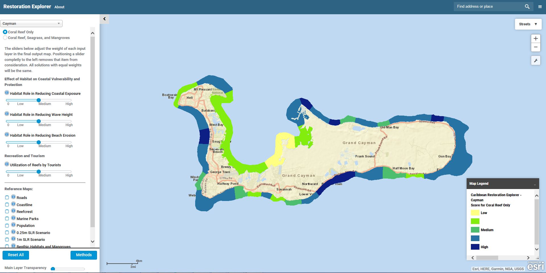
View interactive map here
Cuba
 As Cuba seeks to develop in a sustainable manner, TNC is working with the Cuban government to assess and train employees in modeling the storm and flood protection benefits that coral reefs and mangroves provide. Ecosystem service information is being integrated into future MPA expansion and management plans within the national protected areas network. Using InVEST, qualitative estimates of coastal exposure and the role of habitats during storm events are being analyzed. By combining these results with population information, the model identifies where coastal communities are most vulnerable to wave energy and storm surge, and where coral reefs and mangroves provide a significant role in reducing impacts to these communities. Based on model output, recommendations are being made to include these key habitats within the national system of protected areas, permitting decision makers to more effectively concentrate restoration and protection efforts in areas where people are most likely to benefit from nature’s services.
Reef Adjacent Tourism in the Caribbean (Caribbean Region)
A study by The Nature Conservancy and JetBlue shows the powerful value of coral reef ecosystems to both the tourism industry and to the to the economic success and stability of the region. This study reveals and quantifies the extraordinary value that coral reefs contribute to the Caribbean economy through reef-adjacent activities alone, and the direct connection that reefs have on tourism across the region. The study found that reef-associated tourism is estimated at more than $7.9 billion annually from over 11 million visitors. This accounts for 23 percent of all tourism spending and is equivalent to more than 10 percent of the region’s gross domestic product. This new study, also supported by Microsoft and the World Travel & Tourism Council, reveals and quantifies the significant value that coral reefs contribute to Caribbean economy through reef-adjacent activities such as sailing, diving and snorkeling beach-based activities and the direct connection that reefs have on tourism. A project summary can be found here, while the full report can be found here.
Resilient Islands (Dominican Republic, Grenada, Jamaica, St. Vincent and the Grenadines)
Resilient Islands is a four-year initiative to protect islands against the impacts of climate change by promoting the use of coastal habitats to reduce risks, and by helping governments, partners and communities implement sustainable development plans that prioritize nature.
The Nature Conservancy and the International Federation of the Red Cross and Red Crescent Societies (IFRC) are developing an adaptation toolkit to promote better decision-making and resilience through disaster management that integrates nature-based solutions. The project will also implement innovative nature-based interventions within coastal communities in the Dominican Republic, Grenada and Jamaica. Learn more here.
US Virgin Islands
 We used the InVEST Coastal Vulnerability and Coastal Protection models to map and quantify exposure reduction and protection provided by coastal ecosystems in USVI. TNC is working with the USVI Department of Planning and Natural Resources and Coastal Zone Management to model conservation and development scenarios that enable decision makers to assess tradeoffs with alternative management choices and identify where investment in natural capital enhance human development and conservation. The Coastal Vulnerability and Coastal Protection models identify where coastal habitats are most likely to 1) reduce exposure to erosion and flooding from storms and future sea levels and 2) protect vulnerable people and property. Model outputs are being used to evaluate the ability of nearshore habitats to reduce nearshore wave energy/erosion and mitigate vulnerability – allowing users to explore the potential impacts of management actions (such as the removal or restoration of nearshore habitat) on vulnerability.
Our Approach
Coral reef larvae connectivity
We have designed and implemented the first ocean-current coral reef larvae connectivity model
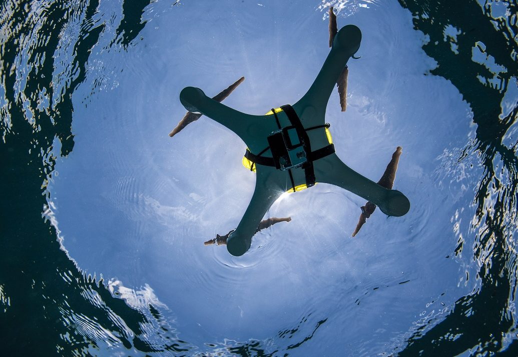
Unmanned Aerial Systems
The Caribbean team has been using Unmanned Aerial Systems (UAS) since 2014 specifically for mapping and monitoring coral reefs and mangroves.
Top image: ©Kermit Amon-Lewis. Photo Credits in Text: © Marjo Aho, © Ian Shive, © Andy Drumm. Tiles (left to right): © Jeff Yonover, © Tim Calver