
Overview
Habitat loss to coastal development is among the most significant of threats to coastal biodiversity and ecosystem health. Historically these habitats were not recognized as providing important benefits and their loss was simply considered to be the collateral damage of commercial fishing and coastal development. Coastal salt-marsh, once perceived as mosquito breeding grounds, has been ditched, drained or filled to “reclaim” land for development. Oyster reefs, once a dominant feature in estuaries, were preyed upon for food, construction materials, or fertilizer and burned in large quantities to make lime. Coral reefs were bombed or poisoned to extract fish or dredged for ship channels and ports as well as being burned for lime production, and seagrass meadows were mown with trawl or dredge gear. Such losses accompanied the dramatic growth in coastal populations around the world. More than half of the world’s population now lives in coastal regions and, without sufficient thought, this has increased the impact on habitats that are sensitive to nutrient and sediment pollution such as seagrass meadows and coral reef.
Thankfully, there is greater awareness today that coastal habitats generate the fish that support our fisheries, protect us from damaging storm surges and contribute to climate regulation. The ‘Mapping Ocean Wealth’ program has focused on documenting the extent of loss of these habitats and on quantifying the value of the services that have been lost, along with the habitat. The high value of these lost services now place coastal and marine habitat restoration, along with conservation of the remaining habitat, as an important priority for coastal communities and businesses.
Recognizing the area, or amount of habitat remaining (or lost) is a motivator for conservation, but even more powerful is a knowledge of the benefits, or ecosystem services, that can be gained through restoration. Predicting and documenting ecosystem benefits in quantitative terms— tons of fish produced, shoreline miles protected, carbon sequestered, polluting nutrients removed etc.—is key to appropriately evaluating return on investment realized through restoration.
Projects
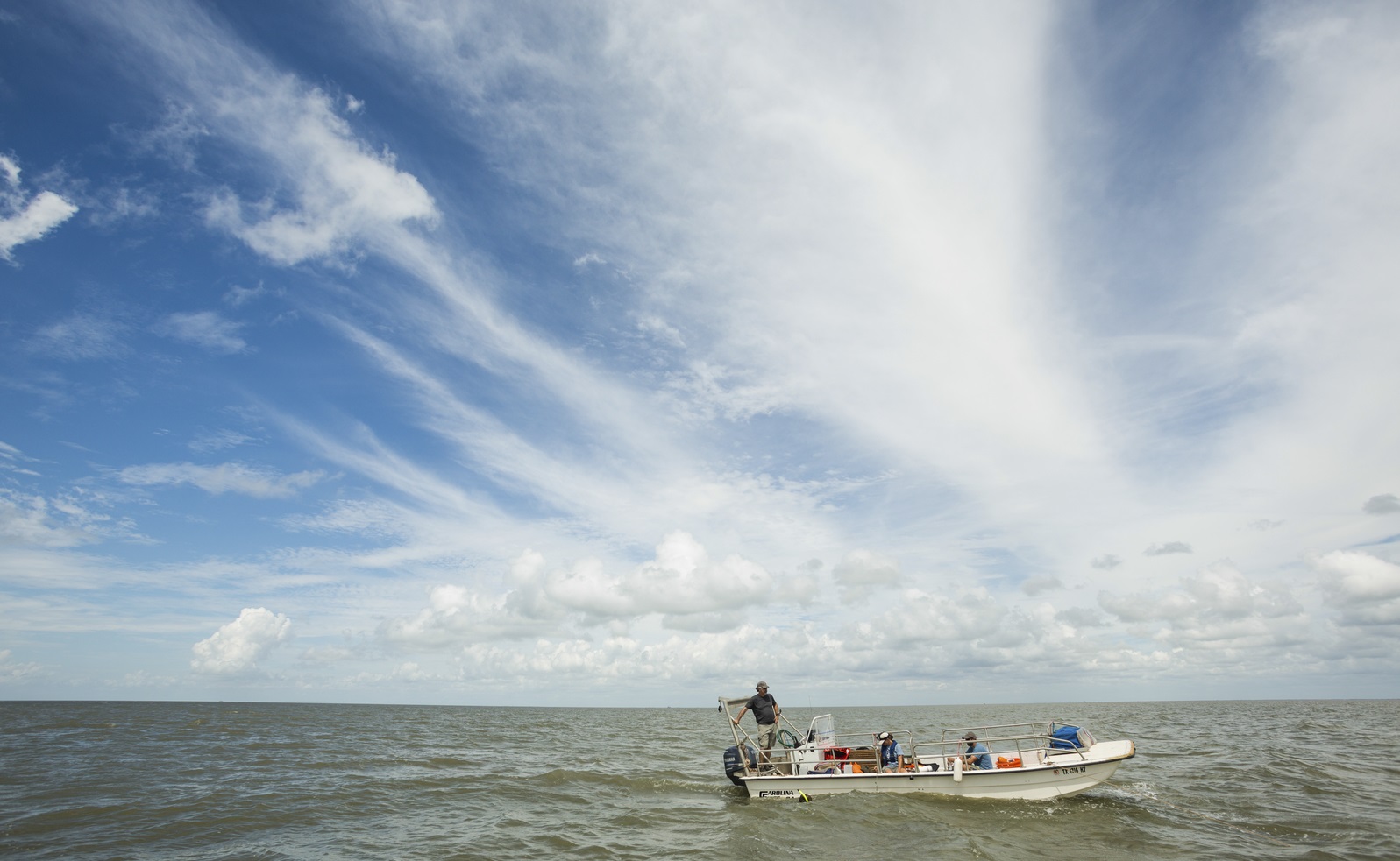
TNC has had a focus on shellfish habitat as one of the ‘critical coastal habitats’ for over 15 years. An early global assessment of the remaining oyster habitat indicated that globally, at least 85% of oyster reef has been lost (Beck et al 2011 or link). This global measure has since been updated by numerous country or state scale assessments (USA- zu Ermgassen et al 2012, South Australia-Alleway and Connell 2015, Australia- Gillies et al 2018).
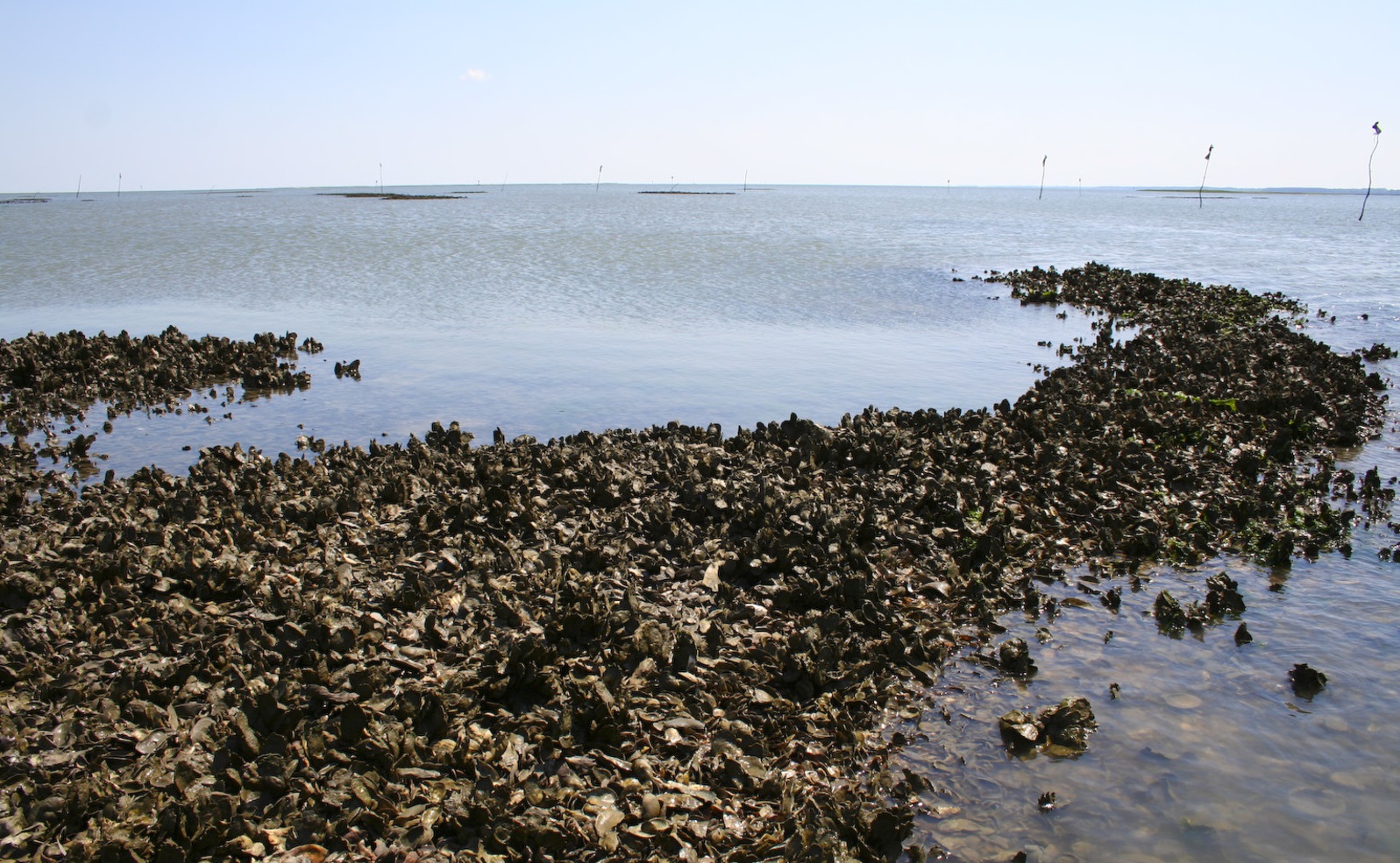
Together with NOAA and numerous partners TNC has focused on quantifying the services provided particularly by oyster reefs and in 2016 the first estimate of the tonnage of fish per hectare per year was published (zu Ermgassen et al. 2016 correction 2018, Tools link). At 3 to 5 tons per hectare for every year this measure has received a lot of attention outside the US (see the Managers Guide – Tools section MOW web site). Both recreational and commercial fishers, fishery managers and sector representatives have recognized the potential to increase the number of fish available to a fishery by restoring oyster habitat. Even without regionally specific measures of fish production, just demonstrating the likely magnitude from the result in the US has galvanized action around much of the world.
In Australia the recreational fishing groups became interested in restoring shellfish habitat in 2014 and TNC joined the Albert Park Yachting and Angling Club and the Department of Fisheries in Victoria to initiate the first oyster and mussel habitat restoration in Port Phillip Bay. Today there are substantial projects in Queensland, New South Wales, Victoria, South Australia and Western Australia, with plans for the first project in Tasmania. Either oyster or mussel habitat projects have also commenced in New Zealand, Hong Kong, China, Mexico, the UK, the Netherlands and Germany. While all of these projects plan to measure additional services such as water filtration, reduced eutrophication through nitrogen cycling, increased biodiversity and increased recruitment of oysters to failing oyster fisheries through improved broodstock and reproduction, it is increased fish production that has tended to be the primary objective for the restoration.
In the US, TNC is working to apply the same methods to estimate fish production from salt-marsh and sea-grass. A variation of the method is being applied to mangrove forests and coral reef to determine fish production from all five critical coastal habitats. NOAA and TNC are working together with commercial fisheries managers to identify how these measures can be incorporated into the stock assessments conducted by fishery scientists and the suite of decisions used by fisheries managers to manage fisheries.
Mangrove forests are important for food production, carbon storage and sequestration, coastal protection, water purification, and tourism, which is why there is an increasing need not only to prevent further loses, but to increase mangrove areas through restoration.
TNC is partnering with IUCN to develop a global model and map of mangrove restoration potential to help practitioners prioritize areas, and as a way to support and encourage mangrove restoration projects globally.
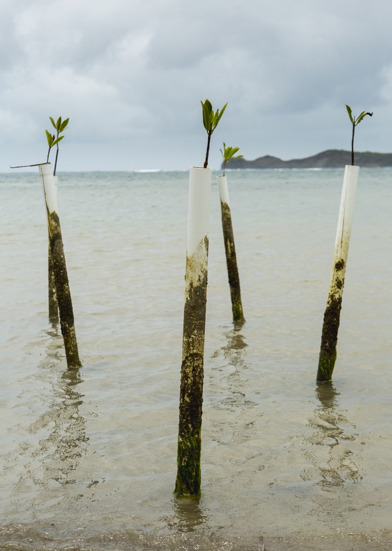
The model will incorporate information on both current and historic distribution of mangrove forests, as well as local drivers of mangrove loss and degradation (e.g., urbanization and industrial development, conversion to agriculture and aquaculture ponds, deforestation for fuelwood or timber, altered freshwater regimes, pollution and coastal erosion), which can vary in extent and severity depending on the region. Environmental (e.g., wave energy, tides) and social factors (e.g., population density, demographics), as well as future projections of sea level rise, urbanization, and weather events are other factors that can influence restoration suitability, and will also be incorporated into the model where possible.
Model results will be used to develop an online mapping and decision-support tool that can be used by environmental groups to show the extent of degraded mangroves, how much land is available for restoration, identify priority restoration areas, and kick-start opportunities for implementing restoration projects. The project will also result in modeled ecosystem service values for restored sites.
Mangroves are rightly considered the poster child for ecosystem service values. By highlighting the long-term value of mangroves, this work can reach beyond the conservation sector to engage governments and local communities in future restoration projects.
The objective of the At the Water’s Edge (AWE) project is to build resilient island communities using nature-based solutions by empowering people to assess the social, ecological and economic risks of climate change and make informed decisions on the use of their coastal environment.
In Grenada, TNC works with community members in Grenville Bay to address the deterioration of the northern barrier reef. Coral reefs protect coasts from erosion and flooding by reducing wave energy that reaches the shore. Numerous human influences have led to a decrease in the coral cover on this barrier reef. When the reef is no longer able to ‘grow’ at a rate faster than the rate of erosion from the constant breaking waves, the reef height begins to decrease. This lowering of the reef severely limits the reef’s ability to protect the coastline from the impacts of wave intensity and storms, leading to coastal erosion and an increase in run-up flooding from waves during storms.
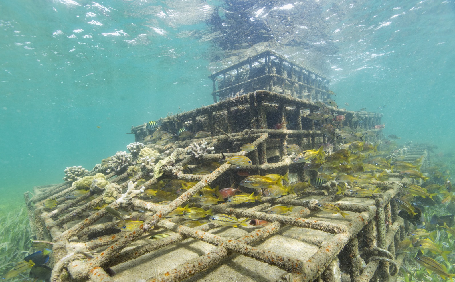
The Grenville project is testing a two stage approach to restore the shoreline protection function of the barrier reef. Initially, an eco-engineering approach was designed to enable the local fishermen to install structures to increase the height of the northern reef of Granville Bay. Re-leveling the reef is designed to reduce wave energy entering the bay, stabilize the shore and minimize flooding. The team are also experimenting with restoring the corals and biological community to these. Reef restoration should allow the reef to grow naturally to keep pace with erosion and sea level rise while also enhancing local fisheries and providing additional benefits to the community.
Addressing the cause of the increased erosion and flooding at the source (the damaged reef, avoids deflecting the shoreline damage to other areas as commonly happens when the problem is addressed by shoreline hardening. Other benefits of this project include the use of community labor, lower costs, and higher ecosystem service benefits, compared to the installation of rip-rap or bulkheads used as shoreline hardening.
Information and data on the coastal protection ecosystem services values that coral reef and other habitats provide can help guide communities towards employing natural coastal protection solutions to address the challenges of sea level rise.
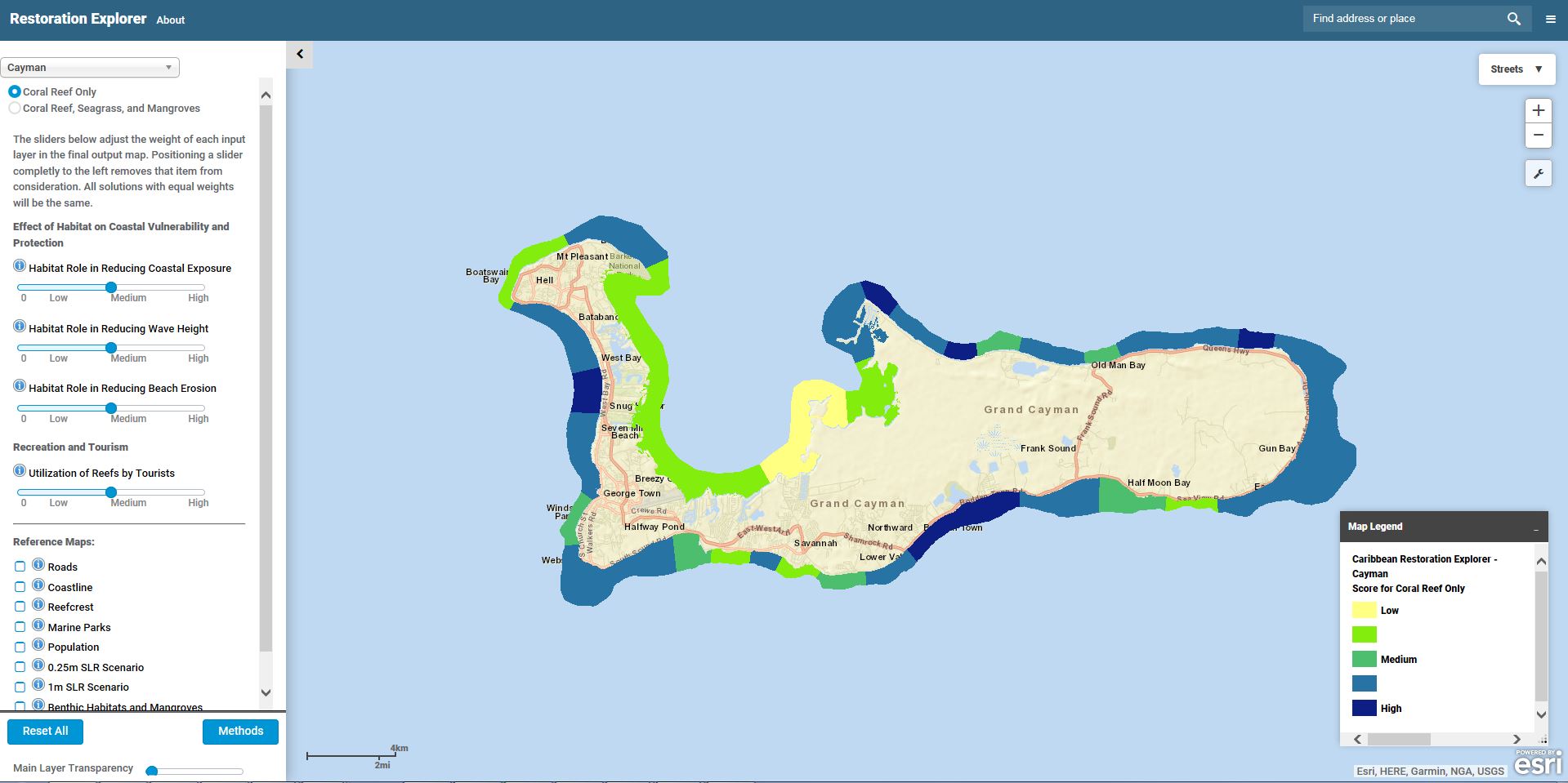
TNC’s Caribbean team has developed web-based tools that can be used to prioritize coral and mangrove restoration sites based on the ecosystem services these coastal habitats provide. There are two separate tools, one for the Caribbean region as well as for the Cayman Islands, specifically. The Cayman Island’s Department of Environment is seeking to expand marine protection and prioritize management and restoration efforts of their coastal habitats. The objective of this tool is to identify where coral reef and mangrove habitats are likely to 1) reduce exposure to erosion and flooding from storms and future sea levels; 2) protect vulnerable people and property; and 3) maintain recreation and tourism appeal that drives the economic engine of the Caribbean. Natural Capital’s InVEST tools were used to model the tourism and coastal defense benefits that these habitats provide. Tourism benefits were modeled using thousands of geotagged photographs from the flickr image hosting site which revealed hotspots and patterns of tourism. Coastal defense benefits were modeled to highlight the protective services offered by natural habitats to coastal populations. The results provide a quantitative representation of erosion and inundation risks along the coastline. This information can help coastal managers, planners, and landowners to develop smarter permitting strategies and identify the mangroves and coral reefs that provide greater coastal protection, thus targeting more focused management or restoration attention on areas that will provide the most benefits.
The Caribbean Restoration Explorer has comparable methodologies and applications, but in addition, uses a regional coral connectivity model, which relies on NOAA’s Real Time Ocean Forecasting System ocean circulation model to analyze coral larval spawning and dispersion events throughout the Caribbean Sea. This allows user to explore important connection patterns among coral habitats across countries and throughout the Caribbean region as a whole (Schill et al. 2015).
The tool can be found at http://maps.coastalresilience.org/caribbean/
Top image: ©Andrew Kornylak. Photo Credits in Text: © Jerod Foster, © Daniel White, © Tim Calver