Ecosystems: Offshore, Hard-Bottom Habitat
Ecosystem Services: Fisheries
Projects and Places: Cashes Ledge
Imagine sitting on a boat 80 miles off the coast of Massachusetts, no land in sight. As you float over underwater landscapessculpted by a retreating glacier during the last ice age, sunlight penetrates the water, giving life to a lush kelp forest and one of the world’s deepest seaweed communities. The ragged slopes, and deep muddy, rocky plateaus, combined with the unique oceanographic conditions created by the underwater mountain range, mean that the offshore banks of the Gulf of Maine are prime habitats for marine life in the Northwest Atlantic Ocean.
Projects and Places
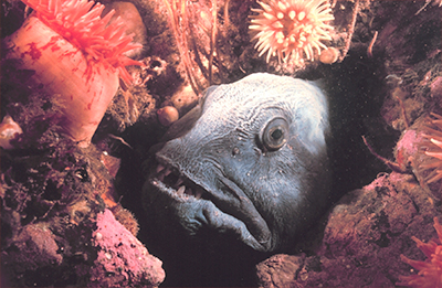
Formed in the last glacial ice age, Ammen Rock, the largest underwater mountain in the Cashes Ledge complex, rises to within 40 feet of the surface. This structure interacts with the cold, nutrient-rich currents circulating through the Gulf of Maine, creating a rich habitat with a vibrant assemblage of plants, sponges, anemones, crustaceans, bryozoans and fish, like the icon Atlantic cod and the toothy Atlantic wolffish.
The Nature Conservancy and Northeastern University have completed an innovative pilot project to study the ecosystem services of the rocky seascape of Cashes Ledge, particularly its viability as an essential fish habitat (EFH). The surface of Cashes Ledge is a mixed terrain of mud, sand, bare rock, cobble, boulders and a small, dense kelp forest. We recognize that some of these habitats are more important than others for particular fish, or at certain critical life-history stages, such as breeding or larval growth. The challenge has been to know exactly which habitats were essential and where they are on a map.
New Ocean Wealth high-resolution maps were developed to chart the exact locations of these different habitats. Combining this information with studies investigating EFH for important commercial species, such as cunner, cod, haddock and cusk, will reveal which parts of Cashes Ledge are most important for these particular species. As expected, there are tight links between certain species, like cunner, and specific habitats such as kelp forest and boulder-rich environments. Furthermore, these fish use the habitat differently as they move through their lifecycles.
Our next efforts will be to use the knowledge gained here to build a model for essential fish habitat for cod over the entire Gulf of Maine. The end-game is simple: by determining the areas that enhance productivity, we can focus conservation efforts around producing more fish—enhancing values for people while increasing ecological stability.
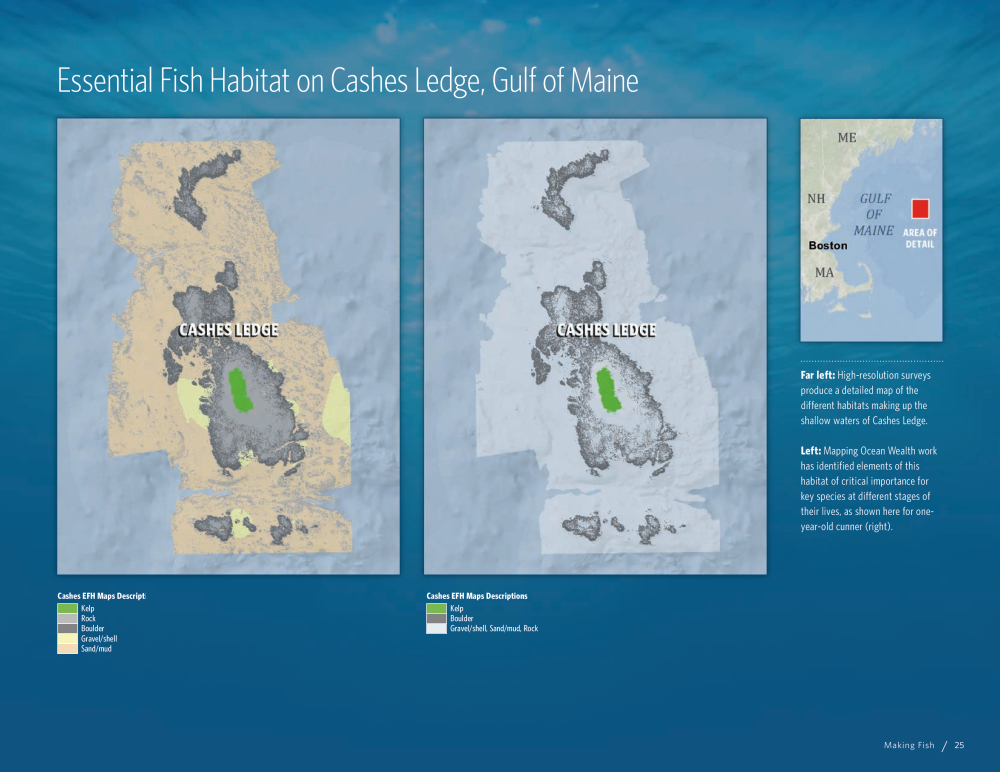
Photo Credits in Text: © Bridget Besaw, © NOAA