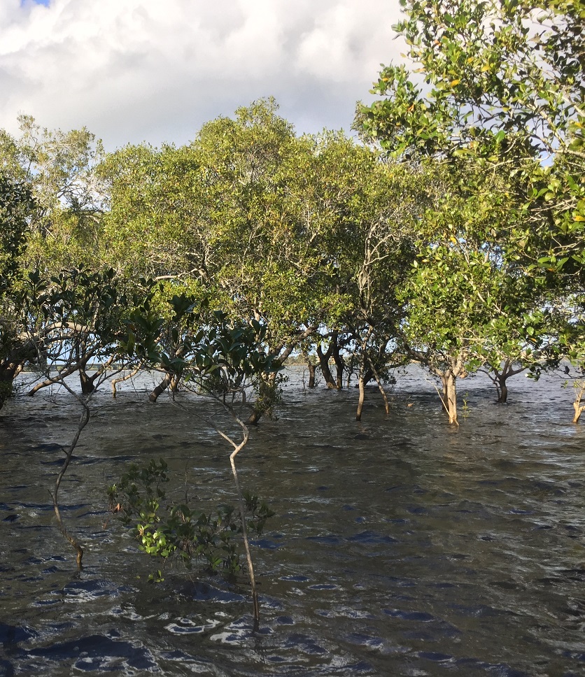
Ecosystems: Mangroves, Seagrasses, Saltmarshes
Ecosystem Services: Carbon Storage and Sequestration, Fisheries, Recreation & Tourism, Coastal Protection
Projects & Places: Richmond River (New South Wales), Port Phillip Bay and Western Port Bay (Southern Victoria)
Approaches: Drones, Mobile Phone & Satellite Technology, Soil Cores
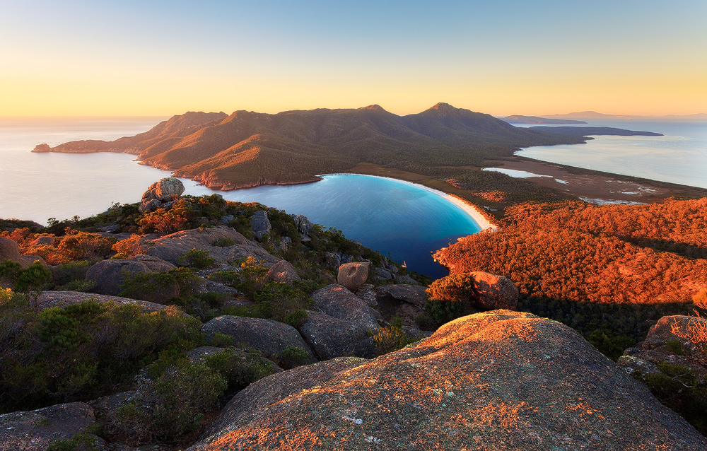
Great Southern Seascapes
The southern coastlines of temperate Australia are home to some of the most diverse collections of underwater seascapes in the world. From giant kelp forests, to vast seagrass meadows, high-latitude mangroves, rose-gold dipped saltmarshes, cool-water corals and kaleidoscopic sponge gardens, 85 percent of the estimated 12,000 marine species here are found nowhere else on Earth.
These seascapes provide over 19 million Australians (80 percent of the total population) and five-out-of-eight capital cities with fresh seafood, abundant recreational opportunities and critical waste treatment and removal. Paradoxically, however, these southern seascapes are also known as the “forgotten coastlines.” Until now, relatively little attention has been paid to protecting or restoring southern coastal habitats and the essential human services they provide. A report released in 2019 reveals the often underappreciated value of Australia’s coastal wetlands.
The Mapping Ocean Wealth project in Australia is a partnership between The Nature Conservancy, Deakin University, Department of Land Water and Planning, Victoria, Victorian Fisheries Authority, Parks Victoria, NSW Department of Primary Industries – Fisheries, and NSW Office of Environment and Heritage with support from The Thomas Foundation, HSBC Australia, Ian Potter Foundation and Australian Research Council.
Additional information can be found in this brochure, or at this website.
Australia’s oceans are expected to contribute $100 billion per annum to our economy by 2025, yet there is increasing uncertainty in how our oceans will cope with growing exploitation and climate change. Thus, our planning, conservation and investment decisions need to factor in the health and resilience of Australia’s oceans.
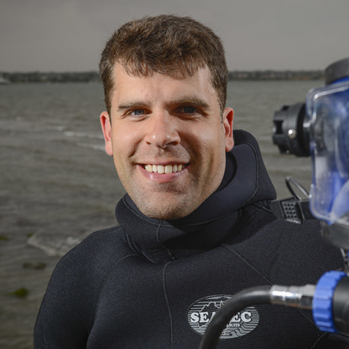
Dr. Peter Macreadie
Deakin University
Projects and Places

It is estimated that Victoria’s mangroves and saltmarsh, store 23 thousand tons of carbon each year, or the equivalent of 18,350 cars. Not only do they store carbon, but they also enhance coastal fisheries, just seagrasses alone, in Port Phillip Bay, enhance our coastal fisheries by 343 tonnes of fish per year, or equivalent to $6.1 million annually.These, and other findings were part of a case study on ecosystem services written for the Commissioner for Environmental Sustainability Victoria and its 2016 State of the Bays Report. This included preliminary maps developed for coastal blue carbon and fish productivity for Victoria.
The team recently published a paper on optimal soil carbon sampling designs based on their work in this region.
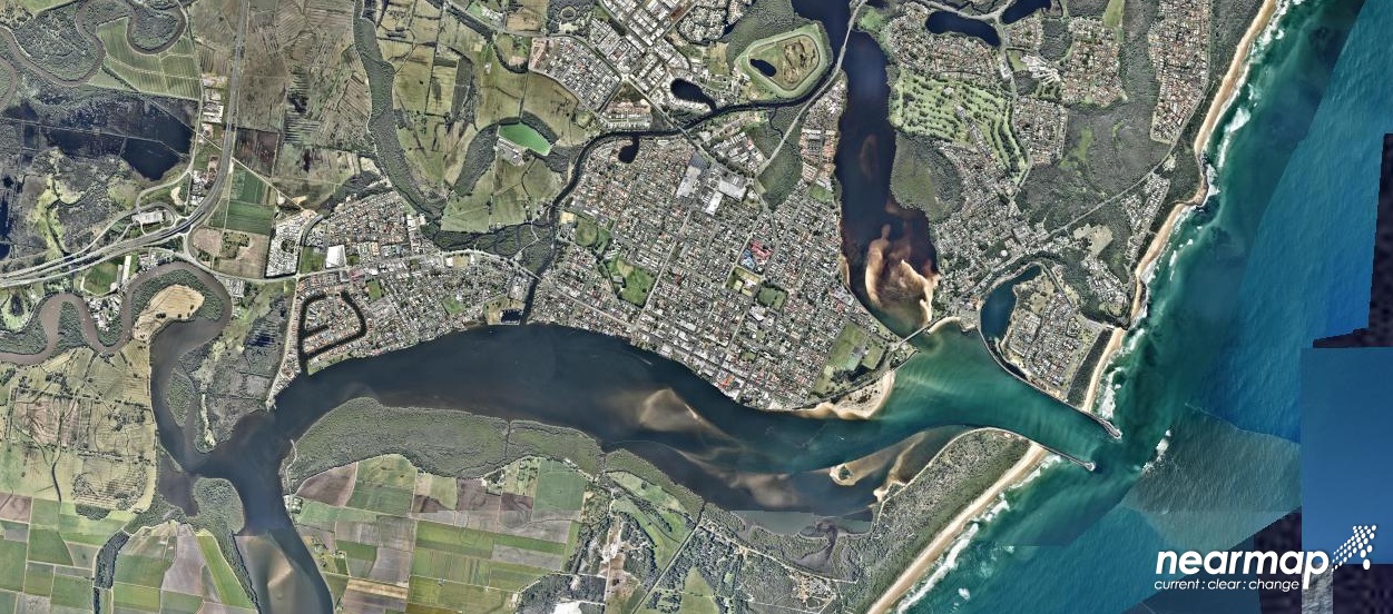
The Richmond River estuary is at the heart of the Northern Rivers region of New South Wales. This region lies 950 km north of Sydney on the east coast of Australia and is an area of outstanding natural beauty, renowned for its rolling green hinterland, subtropical rainforest, rugged coastline and dynamic, productive barrier estuaries.
The Richmond River is one of the five largest estuaries in the region that support highly productive ecosystems and human land uses. The estuary of the Richmond River is a significant natural community asset. For millennia the estuary and surrounding floodplain (the largest in coastal NSW) supported local Bungalung aboriginal communities. European settlement in the area began during the early 1800s with the river used for transportation of timber. As the local population grew and thrived, increasing development and land-use changes have impacted the estuary’s health. Historical and current day activities such as broad scale vegetation clearing, drainage of the floodplain wetlands and changes to vegetation species have led to widespread reduction in the resilience of the estuary and surrounding floodplain.
Over the last 20 years a number of habitat restoration projects have occurred in the Richmond River estuary. Therefore, the Richmond River estuary not only provides the MOW-AUS team with an opportunity to study the delivery of benefits from coastal habitats, but also how restoration can provide additional benefit to the local community. Additionally, the Richmond River also provides a unique case-study to better appreciate the delivery of fish, blue-carbon, and tourism and recreation opportunities for humans by coastal habitats provided by the Northern Rivers region’s estuaries.
View a map of Richmond River blue carbon here.
Our Approach
The generalized Mapping Ocean Wealth method can be summarized as “Review–Model–Map”. By reviewing and analyzing existing information about ecosystems and ecological processes (Review), we can use that information to construct new mathematical models, “production functions”, to better understand the social and economic benefits provided by coastal ecosystems (Model). OzMOW has broadly followed this approach, however data isn’t always available to review, so a new, very conventional step has been added “Review–Collect–Model–Map”. To this end the MOW Oz team have been out amongst Australia’s mangroves, seagrass and saltmarsh collecting new data. The data collecting step has enabled us to use a number of novel and exciting technologies, but also some well established tools of the trade.
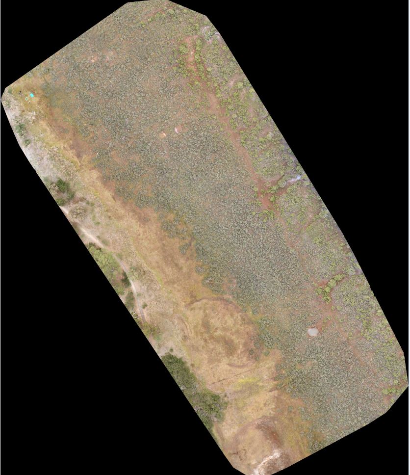
drones
Scientific use of unmanned aerial vehicles or drones is growing.
read more
They are a great tool to collect high resolution imagery, as they increase fieldwork efficiency and reduce costs by increasing the amount of area a research team can cover. OzMOW are using drones to map mangrove, seagrass and saltmarsh vegetation and to generate 3d models enhancing our capacity to monitor the amount of carbon bound in the living tissues (biomass) of these coastal plants.
Some example uses of UAVs by the marine mapping group at Deakin University part of the OzMOW team can be seen here and here.
Mobile Phones & Satellites
Mobile phone and GPS data has recently been used to monitor human population changes almost in real time.
read more
Often it is difficult to monitor human use of coastal ecosystems, particularly in Australia where our coastal ecosystems can be very remote. Using this exciting mobile phone technology, we can track the risk of transmission of infectious diseases (Buckee et al., 2013, Tatem et al., 2014, Wesolowski et al., 2015) and exposure to air pollutants (Gariazzo et al., 2016). OzMOW are hoping to take advantage of recent changes in Australian legislation that has ruled mobile phone location information as non-personal information and to use this information to understand human movements within remote Australian coastal ecosystems and compare these to satellite images where we can identify recreational and commercial fishing boats. Detailed knowledge about human use of coastal ecosystems can provide insight of targeted areas by recreational users, outline areas of high economic interest, and help to prioritize management actions.
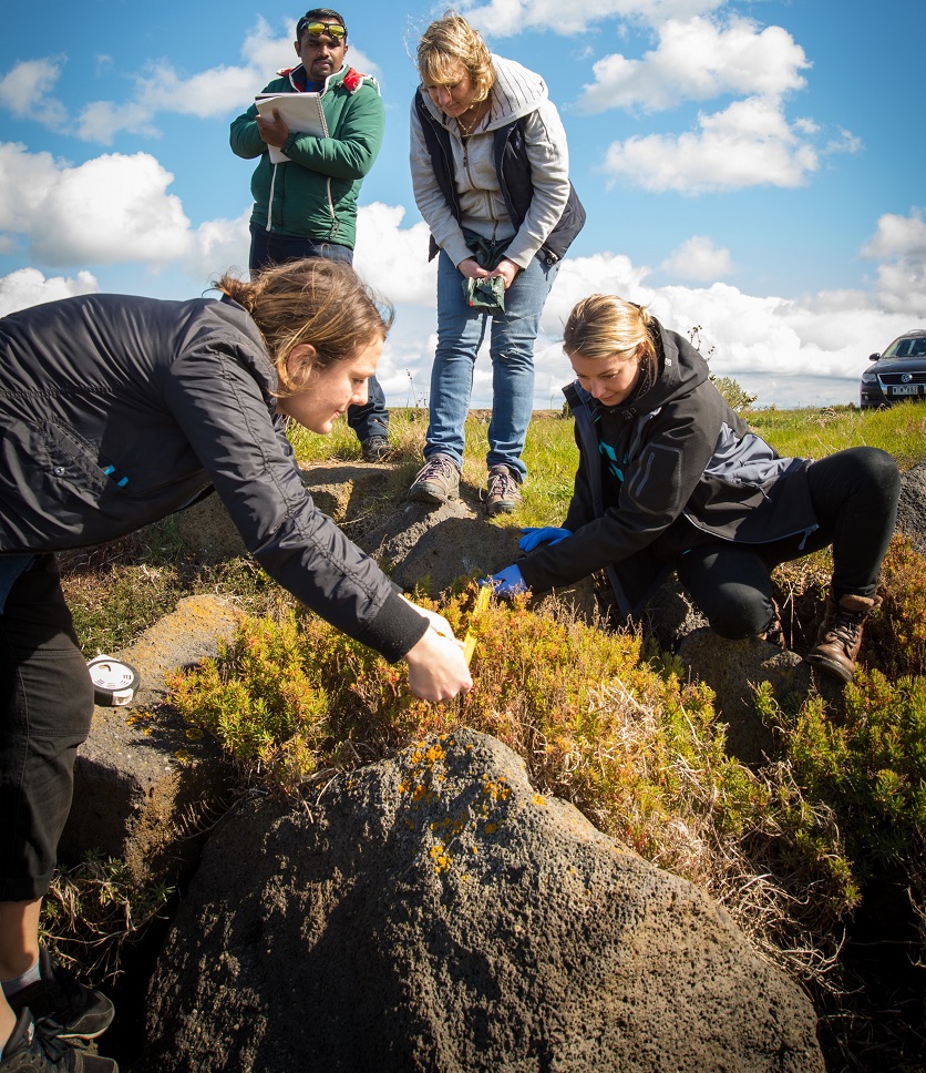
Soil Cores & Measuring Tape
The OzMOW team are collecting sediment core samples and taking vegetation measurements from saltmarsh, mangroves, and seagrasses across southeastern Australia.
read more
We can use sediment core samples to measure blue carbon sediment stocks, as well as the age of the sediment, which is used to calculate the rate that carbon is stored (Carbon sequestration). Vegetation measurements can be used to estimate how much carbon is stored in the form of biomass – leaves, stems and roots, we can there combine the soil cores and above ground biomass to know how much carbon is stored by different coastal wetland types. By comparing these samples to samples taken in nearby, non-wetland areas, we can calculate the carbon storage and sequestration potential of each ecosystem type, and measure variation in the amount of carbon stored by coastal ecosystems.
Project Team & Partners
Dr. Chris Gilles
Bio
Chris is the Marine Manager for the Australia program where he oversees the Great Southern Seascapes program. This includes accelerating the conservation and restoration of Australia’s temperate marine coastal habitats with a particular focus on restoring shellfish reefs. Chris has previously worked across the science and conservation sector in both freshwater and terrestrial environments but his true passion is marine. He was formally the Director of Science at Earthwatch Australia, where he managed the scientific program across the organization’s expedition and citizen science portfolio. He has created a number of terrestrial and marine citizen science projects, established several national practitioner networks and developed corporate sustainability learning programs. Chris received his PhD in marine ecology from Southern Cross University where his research focused on Antarctic underwater food webs. He is a three time Antarctic summer expeditioner.
Dr. Peter Macreadie
Bio
Dr Peter Macreadie is a marine ecologist specializing in climate change mitigation using coastal ‘blue carbon’ ecosystems. Macreadie received his PhD in Marine Ecology in 2010 from the University of Melbourne. He held a University of Technology Sydney (UTS) Chancellor’s Postdoctoral Fellowship from 2010-13 and an Australian Research Council (ARC) Discovery Early Career Researcher Award (DECRA) Fellowship from 2013-16. He was made a Senior Lecturer at UTS in 2012. Macreadie serves on the Victorian Coastal Council Science Panel and the Australian Government’s National Greenhouse Gas Wetland Inventory Committee. In 2011, Macreadie was listed in The Sydney Magazine’s top 100 most influential people in Sydney. He has received 22 Awards/Fellowships, including: 2016 David Syme Prize, 2015 AMP Foundation Tomorrow Maker Award, 2014 Victoria Innovation Fellowship, 2014 Australian Museum Isobel Bennett Marine Biology Fellowship, 2013 NSW Tall Poppy Award, 2011 Australian Museum Eureka People’s Choice Award Finalist, 2010 American Australian Association Dow Chemical Company Fellowship, and the 2010 Banksia Environmental Foundation Brian Robinson Fellowship.
Dr. Daniel Ierodiaconou
Bio
Dan specializes in cross-disciplinary approaches using geospatial datasets for environmental and ecological applications in terrestrial and marine environments. Dan’s research has focused on biological habitat mapping integrating remotely sensed geophysical and biological datasets using automated classification approaches for examining relationships between habitat spatial complexity and the distribution of marine flora and fauna, assessment of Marine National Parks and linking genetic data with seafloor structure information to unravel phylogeographic patterns.
DR. EMILY NICHOLSON
Bio
Dr Dr Emily Nicholson’s research focuses on solving problems in biodiversity conservation. Emily’s current research interests include measuring change in biodiversity, predicting the impacts of change, and making conservation decisions. Emily also works on ecosystem risk assessment, mainly with the IUCN Red List of Ecosystems.
Most of Emily’s research is quantitative and usually involves modelling of some description. Emily is also very interested in gender equity in science, and more broadly, and has authored articles and blog posts on the topic.
DR. SIMON REEVES
Bio
Simon is the Mapping Ocean Wealth Coordinator for the Nature Conservancy’s Australia program. The Mapping Ocean Wealth Program aims to quantify and communicate the benefits that Australia’s marine habitats provide to people. In this role he facilitates daily running of the program, including partner relationship support and ongoing communication. Alongside his role at TNC, Simon is finishing his PhD examining resilience of temperate reef systems in urban settings. This research was heavily field focused and saw him spending long hours underwater undertaking surveys and experiments elucidating the factors that contribute to the collapse or recovery of temperate reef habitats. Simon has also worked in a number of roles managing and supporting field programs undertaking oceanographic and biological sampling from the tropics to Antarctica.
DR. MARY YOUNG
Bio
Mary completed her Bachelor’s degree in Marine and Coastal Ecology at California State University, Monterey Bay where she also worked as a lab manager for the Seafloor Mapping Lab. During her time at the Seafloor Mapping Lab, she participated in the California Seafloor Mapping Program which mapped the coastal waters of California out to 3 nautical miles. During this time, Mary gained vast knowledge in the acquisition and processing of multibeam, sidescan and interferometric data She then went on to complete her Ph.D. in Ecology and Evolutionary Biology at the University of California, Santa Cruz in the Raimondi-Carr Lab.
DR. PAUL CARNELL
Bio
Paul’s research career has a focus on environmental science that sits at the interface between high-quality research and science-based management of ecosystems. From further developing the science to offset carbon emissions through wetland restoration and protection, to the management of resilient coastal ecosystems. Paul has developed strong skills in experimental design and data analysis that underpins all of his work. Paul also has a strong background in fieldwork on marine and freshwater ecosystems, including seagrass, mangroves, saltmarsh, kelp forests and inland wetlands. It is in these coastal and inland wetland habitats, that Paul has been leading carbon stock assessments in the Blue Carbon Lab over the last couple of years. Through these projects Paul has developed strong relationships with Parks Victoria, Catchment Management Authorities in Victoria and New South Wales, Greenfleet and The Nature Conservancy.
DR. BIAO HUANG
Bio
Biao undertook his bachelor degree in geology in China, following this up with an MS and a PhD in agricultural, resource, and ecological economics at universities in resource management and ecosystem services. He is particularly interested in understanding feedback among complex ecological systems, human decisions, and the management of coupled ecological-economic processes. Biao works in several applied areas including natural resource economics and policy, climate change and land use.
DR. CLARE DUNCAN
Bio
Clare’s main research interests lie in the impacts of processes of global environmental change, and specifically climate change, on ecological systems, and in developing effective conservation strategies in the face of these challenges. Her PhD project focused on assessing the success of conservation projects targeted at restoring and protecting mangrove forests abilities to facilitate ecosystem function into the future. Clare’s PhD applied multi-disciplinary approaches to assess the functioning of mangrove forests through time, combining field and satellite-based monitoring techniques.
HOLGER JÄNES
Bio
Holger’s research interests lie in fisheries ecology and how the quality of a given habitat influences the services and benefits they provide.
ALEJANDRO NAVARRO
Bio
Alejandro’s research interests lie in spatial mapping and analysis of coastal marine habitats in order to quantify the economic and ecological services provided by these ecosystems.
JAMI BUTLER
Bio
Jami’s research interests are in the field of marine ecology, in particular the protection and conservation of coastal ecosystems such as mangroves and salt marsh. She is currently working on her honours project titled ‘Southeast Australian saltmarsh allometry, biomass and blue carbon’. In this study she aims to develop allometric biomass equations for a range of Southeast Australian saltmarsh species, enabling accurate quantification of stored biomass and carbon stocks. This project will form an integral part of saltmarsh biomass mapping and monitoring, and carbon stock quantification within the Mapping Ocean Wealth project.
ASHLEY WHITT
Bio
Ashley’s career as a coastal ecologist has focused on understanding anthropogenic impacts to coastal communities in oyster reefs, seagrass, saltmarsh and mangroves. “The aim of her PhD project is to develop fundamental knowledge of how coastal catchments should be managed to protect and conserve important coastal vegetated habitats under future climate change.”
JAYA KELVIN
Bio
Jaya’s research interests lie in hydrodynamic model and field observation in order to upscale the economic valuation of coastal vegetations based on wave attenuation and reduced erosion provided by seagrass, mangrove, and saltmarsh.
DR. PAWEL WARYSZAK
Bio
Dr Pawel Waryszak is a research assistant at the Blue Carbon Lab, Deakin University, Australia. Pawel is actively supporting various projects collecting critical data that will inform wetland management and climate change mitigation policies.
Prior to joining the Blue Carbon Lab, Pawel worked as a faculty adjunct working in the wetland communities of the Gulf Coast (Louisiana, USA), where he gained valuable experience conducting fieldwork in subtropical wetlands and analysing large long-term coastal restoration data. Pawel received PhD from Murdoch University (Western Australia) in 2017 after working on a project that aimed to provide solutions to optimize restoration success of the threatened ecological community of Banksia woodland of Swan Coastal Plain.
Publications
The Application of Unmanned Aerial Vehicles (UAVs) to estimate above-ground biomass of mangrove ecosystems. Navarro, A., Young, M., Allan, B., Carnell, P., Macreadie, P. Remote Sensing of Environment. (2020).
Quantifying welfare gains of coastal and estuarine ecosystem rehabilitation for recreational fisheries. Huang, B, Young, M.A., Carnell, P.E., Conron, S., Ierodiaconou, D., Macreadie, P.I., Nicholson, E., Science of the Total Environment (2020).
Quantifying fisheries enhancement from coastal vegetated ecosystems. James, H., Macreadie, P.I., Zu Ermgassen, P.S.E., Gair, J. R., Treby, S., Reeves, S., Nicholson, E., Ierodiaconou, D., Carnell, P. Ecosystem Services (2020).
Stable isotopes infer the value of Australia’s coastal vegetated ecosystems from fisheries. Janes, H., Macreadie, P.I., Nicholson, E., Ierodiaconou, D., Reeves, S., Taylor, M.D., Carnell, P.E. Fish and Fisheries (2020).
Mapping Ocean Wealth Australia: The value of coastal wetlands to people and nature. Carnell, P.E, Reeves, S.E, Nicholson, E., Macreadie, P. Ierodiaconou, D., Young, M., Kelvin, J., Janes, H., Navarro, A., Fitzsimons, J., Gillies, C.L. The Nature Conservancy, Melbourne. (2019).
Optimal soil carbon sampling designs to achieve cost-effectiveness: a case study in blue carbon ecosystems. Young, M.A., Macreadie, P., Duncan, C., Carnell, P.E., Nicholson, E., Serrano, O., Duarte, C.M., Shiell, G., Baldock, J., Ierodiaconou, D. Biology Letters (2018).
Image credit: © Simon Reeves