
Ecosystems: Mangroves, Sargasso, Rocky Reefs, and Pelagic Ecosystems
Ecosystem Services: Fisheries, Recreation & Tourism
Projects and Places: Nature-Based Tourism in Baja, Food Production in the Gulf of California
The Gulf of California and Northwest Pacific Coast of Mexico support a quarter of the world’s marine mammal species. A highly productive sea, the Gulf is dotted with 900 islands and fringed with numerous coastal habitats. The Baja Peninsula’s marine waters also support Mexico’s most important fisheries, providing US$223 million to the country’s economy in 2013. It is also a major tourist destination, contributing an additional US$2 billion annually. While critical to Mexico’s national economy, fishing and coastal development threaten to destroy the very ecosystems that produce fish, create the beauty that attracts tourists and buffer the coast from storms.
Sixty conservation organizations currently work in the region with most efforts organized around individual sites without a system-wide vision. Mapping Ocean Wealth improves our understanding of the region as a whole, illustrating how high-value ecosystem services are distributed within the Gulf of California and Mexico’s Northern Pacific region.
Our work will provide the first estimates of the economic impact of ecotourism and fishing industries in the Gulf of California region as a whole, and highlights the importance of the region for these activities
Projects and Places
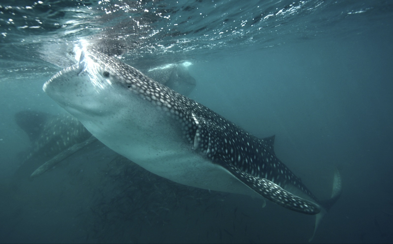
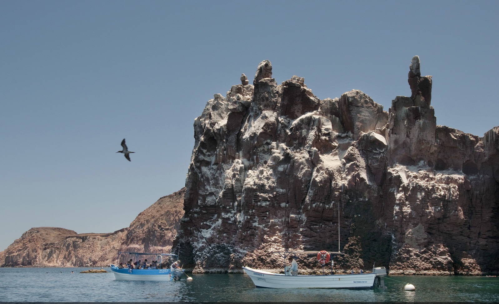
The Gulf of California and Baja California Peninsula are renowned for coastal and marine ecosystems blessed with remarkable diving and snorkeling, game-fishing, kayaking and wildlife watching opportunities. Abundant marine life includes iconic whale nurseries, sea lions, whale sharks and pelagic fish. The area receives 3.8 million visitors annually.
The Mapping Ocean Wealth team in Mexico and partners in the University of British Columbia quantified the importance of nature-based tourism in this region, combining data from national and local governments with new information gathered through interviews with tour operators and the tourists themselves. View the report here and the associated paper here. An analysis of academic ecotourism literature, also conducted by the project team, can be found here.
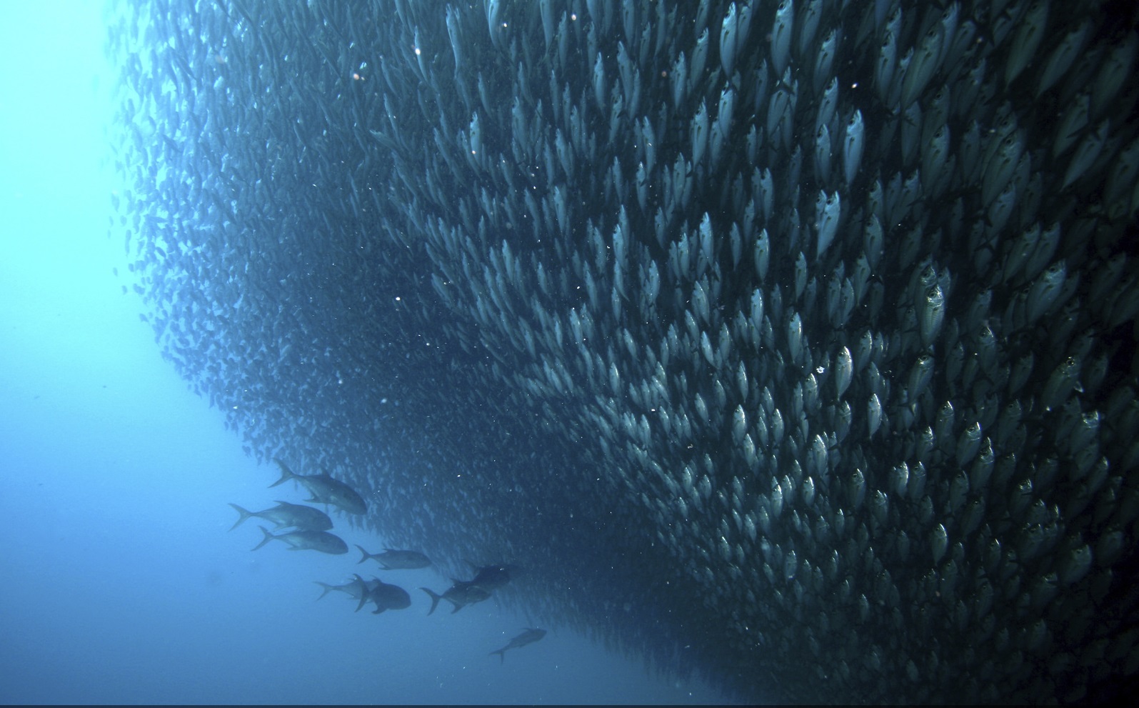
Marine fisheries in the region account for 70 percent of Mexico’s fisheries catches, an industry dominated by small-scale, artisanal fishers. Unfortunately, fishing pressure is hurting the system—there are 1,500 coastal settlements and populations are growing fast, leading to increasing fishing pressure. There are now some 23,000 artisanal fishing boats, a 30 percent increase from 2006 to 2015. These catch over 200,000 ton of fish every year.
While fishing takes place across the Gulf, certain key habitats play an important role in enhancing fish production, including mangroves, but also offshore rocky reefs and areas of sargassum (large seaweed). Mapping Ocean Wealth partners at the Scripps Institution of Oceanography, Comunidad y Biodiversidad A.C. and the Centre for Marine Biodiversity and Conservation in La Paz, Mexico, are building a set of detailed maps to explore the patterns of fish production and catches, and how these are linked to different habitats.
The approach has been to use recent fish catch data to understand how much is being caught and where. In-water fish surveys are also being used to model underwater biomass and to understand linkages between different fish and their habitats. In parallel, we have built habitat maps. Mangroves were already well-mapped, but for reefs and sargassum we had to use potential distribution modelling approaches.
We will develop a new method of estimating the fishing pressure throughout the Gulf that helps to highlight areas of particular concern, such as areas with important habitat coverage, high fishing pressure, but low total catches. This work is still in progress, but already we can see that fishing values are closely linked to key, habitat-dependent species, and that fisheries are in decline. Next steps will enable the MOW team to better understand what levels of fishing are sustainable, and to use scenario modeling to inform possible management approaches. For example, some of the fisheries data could be used to design a regional network of no take zones within the Gulf of California.
What the models show
- There is relatively little overlap between mangroves and rocky reefs, while sargassum is often linked to rocky reefs, particularly in the north.
- Underwater the areas of highest fish biomass are consistently in the southern half of the Gulf
- The highest economic values for fish (partly related to biomass, but also determined by species), are clustered around the Midriff Islands in the north-central Gulf, around the southeast peninsula, and around Puerto Vallarta
- Initial estimates suggest that the artisanal fishing fleet is unsustainable, reducing the net value of fish biomass by 2% each each year.
- At this rate the economic worth of the Gulf’s fish biomass may well be comparatively exhausted and negligible within 40 years.
Project Partners
- Gulf of California Marine Program
- Scripps Institution of Oceanography through the Center for Marine Biodiversity and Conservation
Top image: © Edward Porter. Photo Credits in Text: © Mark Godfrey, © Carlos Aguilera Calderón