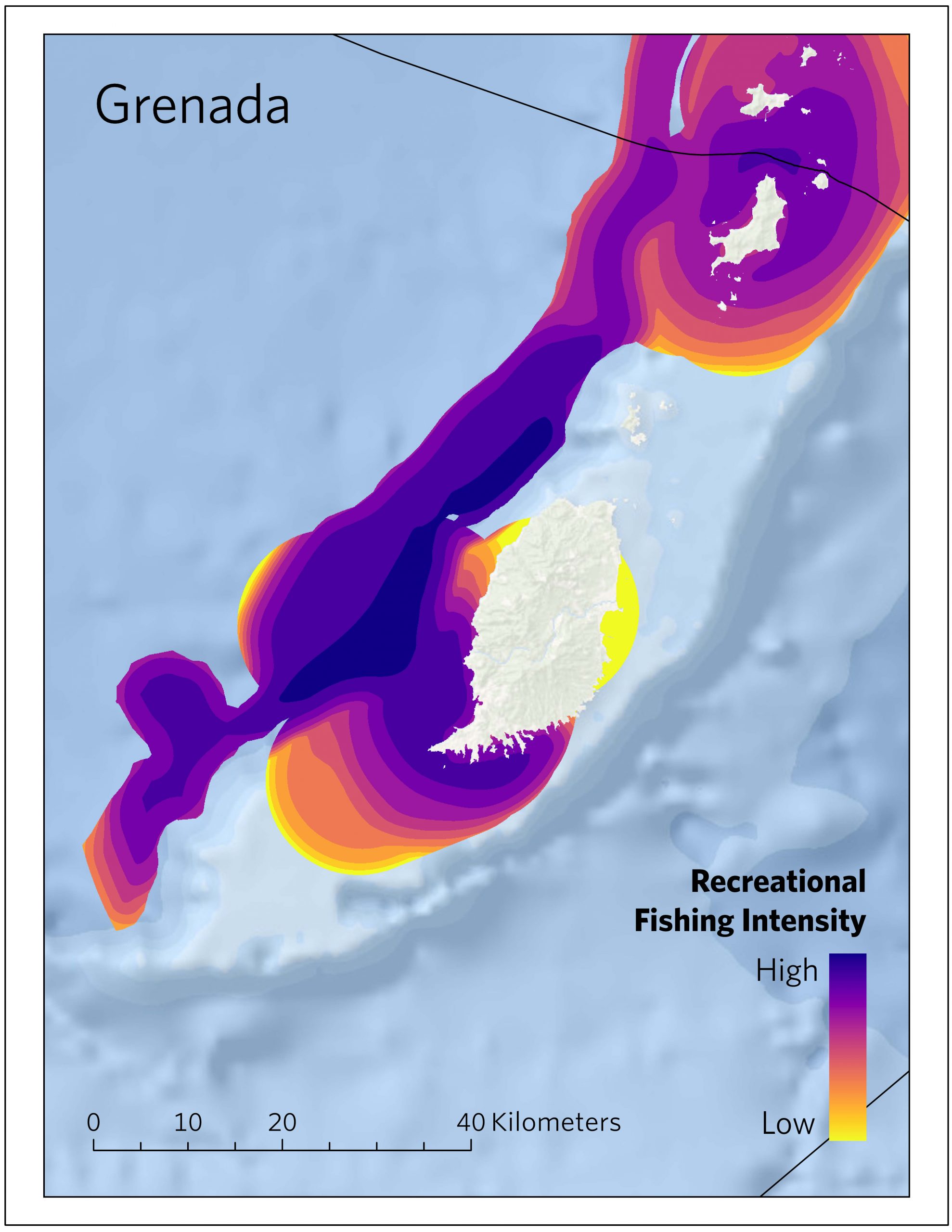
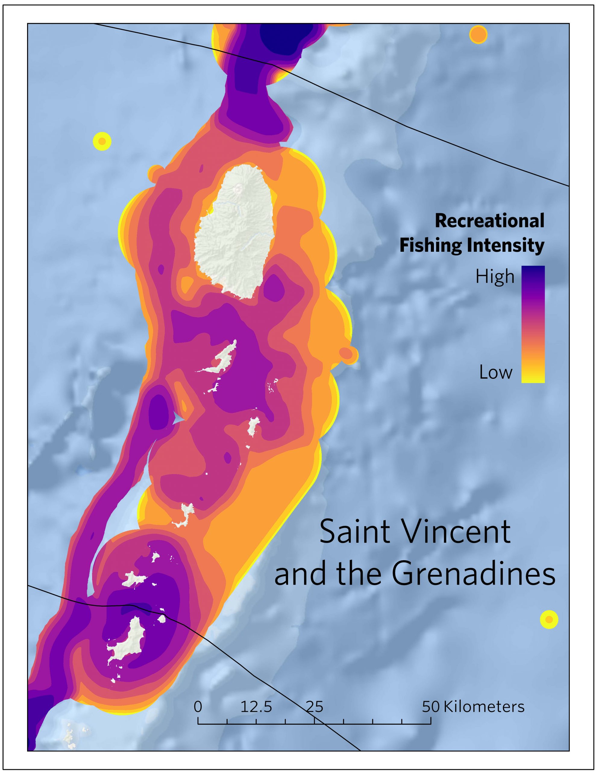
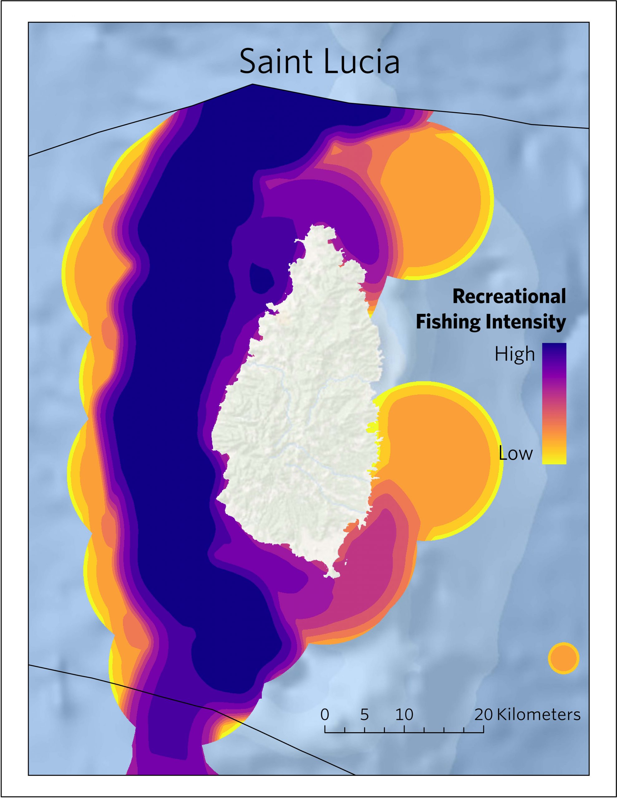
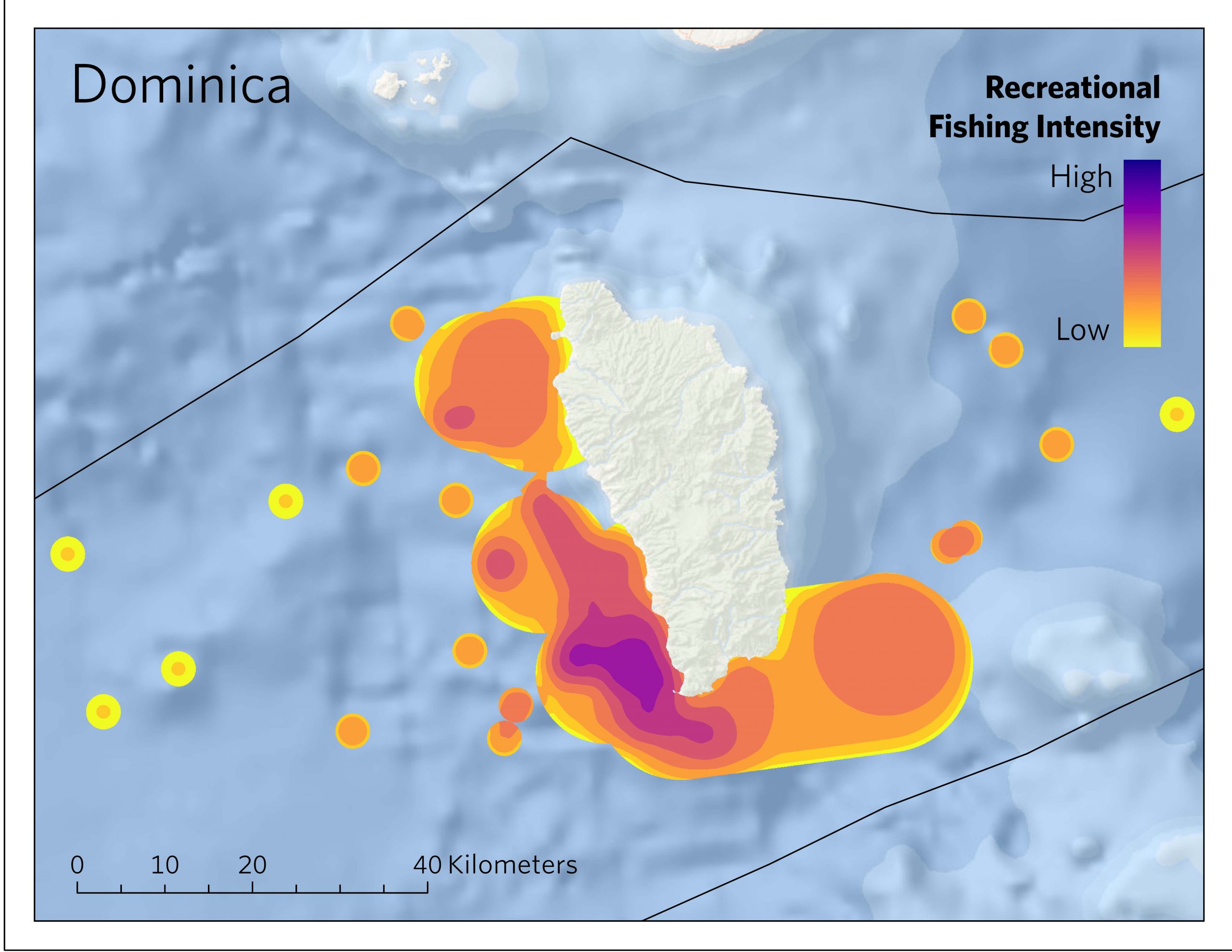
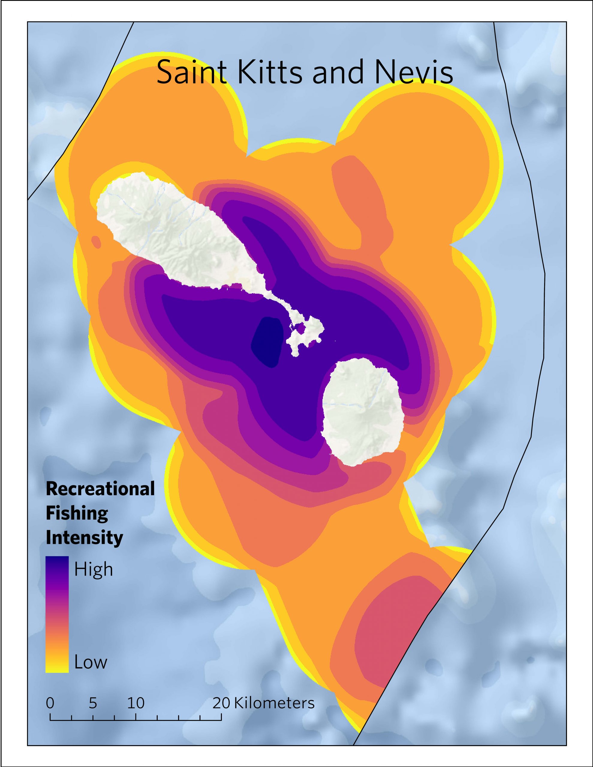
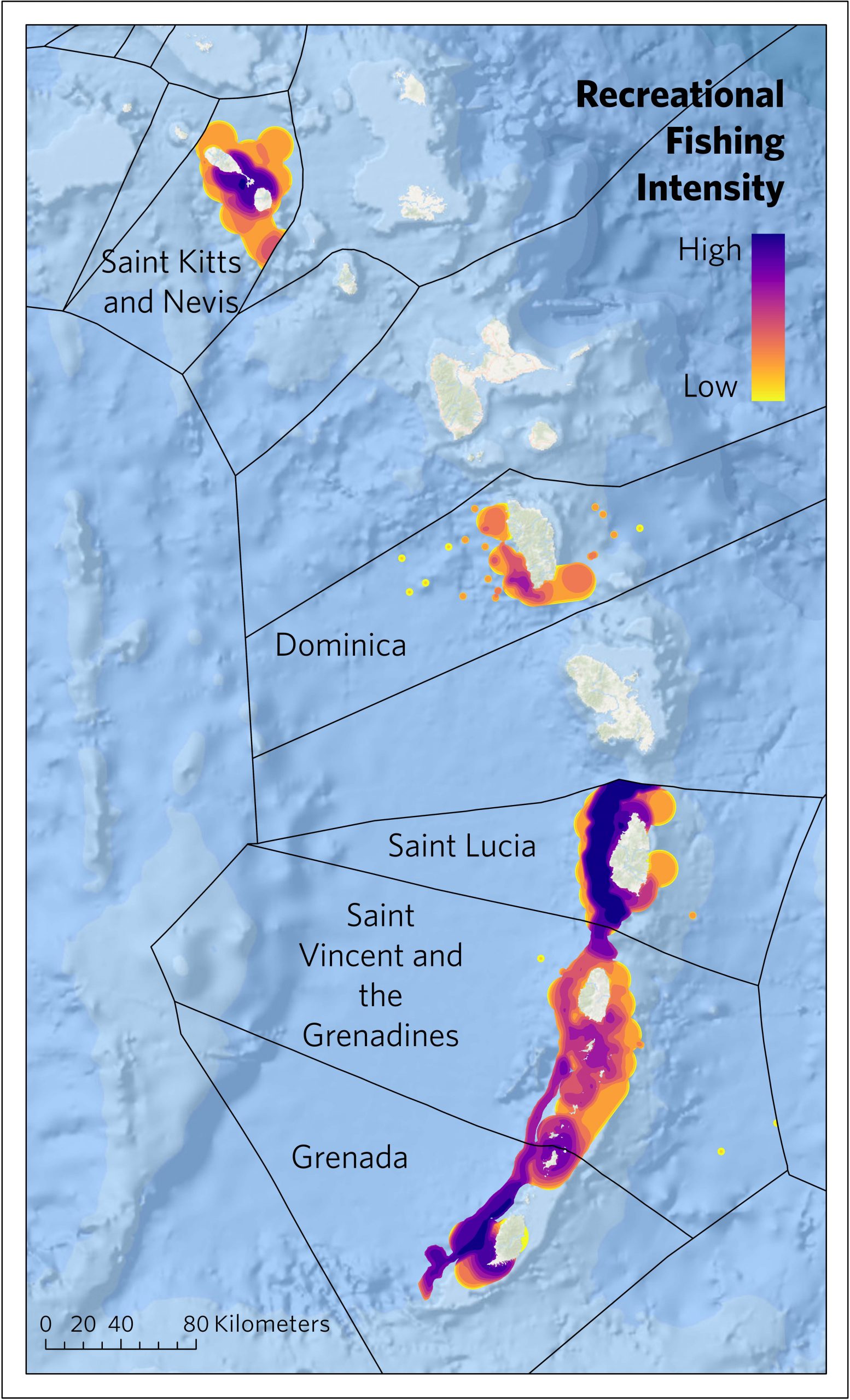
The Caribbean is more dependent on the travel and tourism sector than any other region worldwide. This sector is almost entirely focused on coastal areas, notably through beach-based activities, cruise tourism and in-water activities including sailing, and diving, and other vessel-based activities. There has been intentional development of the recreational fisheries sector as an activity for tourists visiting the region and today, much of the recreational fishing in the region takes place from private or chartered vessels or during fishing tournaments. However, historical attempts to collect standardized data on this sector at a regional level have been limited, and spatial characterization of this activity has been especially lacking.
This project addressed this gap using a combination of image analysis applied to crowd-sourced data from Flickr and TripAdvisor, complemented by participatory mapping and survey data from charter vessel operators, as well as other stakeholder-provided information and guidance. The result is a map of recreational fishing intensity for CROP countries, as well as several complementary summary statistics intended to further emphasize the importance of this sector to the region’s economy.
While the financial assessment is drawn from a relatively small sample size, the results indicate a direct expenditure of over $US 6.8 million per year.
This is the first time that this activity has been so extensively mapped at the regional scale. We believe that the results are of considerable use for better understanding the value nature-based tourism, applicable to management, that they will enable a broad range of users from the public to industry to government to better plan and manage both the tourism industry and any other active sectors within the blue economy.

Image Credits: © Daniel Oberg/UnSplash

