
New report maps the benefits of coastal wetlands in flood reduction on a global scale
by Dr. Mark Spalding
During a major storm, the sea level can rise, sometimes by metres, driven by the winds and low atmospheric pressure. This is a storm surge. If it arrives at a shore the same time as a high tide, that can add another metre or two of depth. Such super-high waters can remain for hours, even days. And it’s easy to see why we call them “surges” because as the water reaches the land it can literally surge over sea defences or flow over coastal lowlands – submerging people, property and infrastructure.
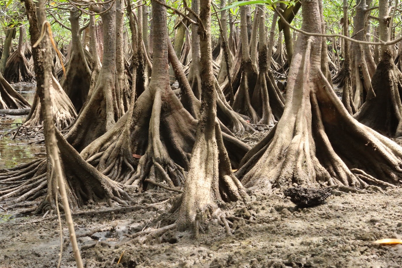
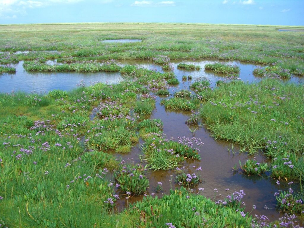
For decades now, we’ve been aware of a rather surprising fact. That coastal wetlands – mangrove forests and tidal marshes – can reduce storm surges. Clearly, they are not like walls holding back the storm: water can flow over a marsh or through a mangrove. Rather, what they do is slow the flow, baffling and adding friction. Every single plant adding just a bit more resistance. So it takes a lot of plants, but if a coastline is cloaked in a wide mantle of green this can notably slow the surge, even until the storm passes. The water piles up on the outside a little more, while on the landwards margins, the depths are lower than they would be without any wetlands present. In turn, this means there are fewer homes destroyed, a lower risk of fatalities, and the damage to infrastructure is reduced.
In a remarkable new study, our colleagues in Delft University and in the applied research institute, Deltares, have used ground-breaking new models to map the benefits of coastal wetlands in flood reduction on a global scale. Earlier studies at this scale were low resolution and worked by modelling thousands of transects of water flowing in straight lines across the shore profile. This is one-dimensional modelling. In reality, water doesn’t flow in straight lines, and will take the path of least resistance, flowing through open spaces and channels enabling the surge to reach further, and faster. Our new approach used a 2-dimensional model (and massive amounts of processing power) which is far closer to reality. The result is that the estimates of value are lower than the previous model, but they are also far more realistic. They are compelling.
The model includes multiple scenarios, but for the 1 in 100 year storm it shows that wetlands reduce flood depths in coastal wetland regions worldwide by 31%, and the overall extent of flooding by 10%. The value of such processes includes an overall 3% reduction in damage to infrastructure, saving $230 million per year world-wide, and the protection of 93,000 people per year from coastal flooding.
The maps also show us where these benefits are of particular importance. Mangrove nations including Indonesia, Colombia, Bangladesh and Tanzania are among the major beneficiaries. Tidal marshes or saltmarshes, being lower and simpler structures, are less powerful in reducing surge, but nonetheless they remain important, and in countries such as the United States, and the United Kingdom, they provide critical benefits.
Future scenarios from the model looked at the role coastal wetlands might play in a future world. Under a high emissions scenario (RCP8.5) for 2100 sea levels are expected to rise by around 0.8m on average. We looked at two extremes. Under the first we assumed wetlands could remain in place, helping to bind sediments and keep up with the rising waters; under the second we kept them at the same elevation and assumed that many would thus become submerged and lost. Reality will probably be somewhere between the two.
The results from this future-casting are critical. If wetlands can keep pace with sea level rise, and/or migrate inland the benefits will remain broadly comparable in terms of effect. If there is no change in wetland elevation over this time-frame, almost all of these benefits will be lost. The message is clear: while we battle to halt greenhouse gas emissions we must start adapting. For coastal wetlands that means a combination of allowing or encouraging processes that may help them to “keep up”, such as maintaining the delivery of sediments down our rivers to the coast, and also allowing them to move landwards as the sea rises, a process sometimes known as managed retreat. We simply cannot afford to allow them to be squeezed between the rising sea and the adjacent land.
Our model, for now, is just about storm surges. But wetlands also attenuate waves. Short-waves, driven especially by storm winds, can further lift the sea level in a process known as wave setup. We were able to test the additionality of bringing in wind-waves on top of our models. In some places it didn’t make any noticeable difference, which is because mangroves and marshes are typically located in sheltered areas where the waves have already broken before they get to the ecosystem. But in a few places they add a few percentage points to flood depths and extents. This makes our model perhaps a little conservative, and gives us a next-generation challenge for the modelling, but we don’t think it will radically change the findings.
It’s been a tremendous piece of work and I’d like to thank all the co-authors – Vincent Van Zelst, Timothy Tiggeloven, Arjen Luijendijk, Tom Worthington, and Bregje Van Wesenbeeck. We’ll be submitting for publication very soon and sharing the maps for exploration at the same time.
Another thing: Mangroves entangle debris which is one of the major killers during storms: by trapping tree trunks, cars, boats, even houses, they greatly reduce overall damage. They also prevent people being washed out to sea. The porosity of these ecosystems also means that after the storm, the water can drain back. This is in contrast to water caught on the wrong side of sea walls, which can take days or weeks to drain. Such standing saltwater can ruin agricultural land.